Arad, Israel
- For other uses, see Arad. For the archaeological site, see Tel Arad.
| Arad | ||
 |
||
|
||
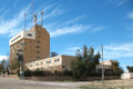
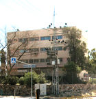
 Arad
|
||
| District | South | |
| Government | City (from 1995) | |
| Hebrew | עֲרָד | |
| Arabic | عراد | |
| Name meaning | Named after Tel Arad | |
| Population | 23,300[1] (2007) | |
| Area | 93,140 dunams (93.14 km2; 35.96 sq mi) | |
| Mayor | Tali Ploskov | |
| Founded in | 21 November 1962 | |
| Coordinates | ||
| Website | http://www.arad.muni.il | |

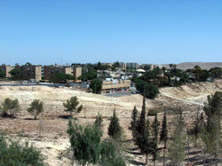
Arad (Hebrew: עֲרָד (audio); Arabic: عراد) is a city in the South District of Israel. It is located on the border of the Negev and Judean Deserts, 25 kilometers (15.5 mi) west of the Dead Sea and 45 kilometers (28.0 mi) east of the city Beersheba. The city is home to a diverse population of 23,300,[2] including Ashkenazi and Sephardi Jews, both secular and religious, Bedouins and Black Hebrews, as well as native-born Israelis and new immigrants. The city is notable for its clean, dry air and serves as a major attraction to asthmatics worldwide.[3][4]
Although attempts to settle the area were made as early as 1921, the city was founded only in November 1962 as one of the last two development towns to be established, and the first planned city in Israel. Arad's population grew significantly with the Aliyah from the Commonwealth of Independent States in the 1990s, and peaked in 2002 at 24,500 residents. The city has seen a decline in population ever since.
As the second-largest city in Israel in terms of jurisdiction, Arad contains a number of large public places and facilities, such as the ruins of Tel Arad, the Arad Park, an airfield serving domestic flights, and Israel's first legal race circuit. It is also well-known for its annual music festival, which was one of the most popular annual music events in the country until 1995.
Contents |
History
Arad is named after the Biblical Canaanite town located at Tel Arad (a Biblical archaeology site famous for the discovery of ostraca) which is located approximately 8 kilometers (5.0 mi) west of modern Arad.[5] The Bible (Judges 1:16) describes it as a Canaanite stronghold whose king kept the Israelites from moving from the Negev to the Judean Mountains, although Tel Arad was destroyed over 1,200 years before the arrival of the Israelites. However, Shoshenq I's chronicles seem to mention a settlement in Tel Arad. During the Byzantine period, the location was still correctly identified by Eusebius, and the name Arad was preserved by the Bedouins.[6]
Foundation
The first modern attempt to settle the area was made by the Yishuv, the body of Jewish residents in Mandate Palestine, on 23 February 1921, when the British Mandate government allowed released soldiers from the Jewish Legion to settle in the area. Nine men and two women attempted the task, but after four months were forced to leave because water was not found in the area.[5]
It was not until 15 November 1960, when a planning unit (and a full committee on 29 December) were appointed by the Israeli cabinet to examine the possibility of settlement in the northeastern Negev desert and the Arad area. An initial budget of 50,000 Israeli liras was given to the project which was to be under the leadership of Aryeh Eliav. On 31 January 1961, the final location of the new city was decided (3.5 kilometers (2.2 mi) southwest of Mount Kidod), as well as details about road and water connections. During March 1961, a full city plan for 10,000 and then 20,000 residents was conceived, along with a corresponding map. Yona Pitelson served as the chief architect of the city and was instrumental in its design.[7]
Arad's plan took account of the area's topography and climate. Building blocks were constructed in a way that protected large inside areas from desert sun and winds. Higher density residential areas were also built first in order to give residents the feel of a city and shorten walking distances.[8]
Growth to a city

The foundations of modern Arad were laid when the oil company Nefta built a work camp in the area in July 1961, consisting of six temporary sheds, after oil was found there in commercial quantities.[7][9] The town itself, however, was officially founded in 1962 by a group of young Israelis, most of them ex-kibbutz and ex-moshav members, who were seeking an environment free of the urban ills of overcrowding, traffic, noise, and pollution.[10] The founding ceremony was held on 21 November, and attended by then-Prime Minister David Ben-Gurion. It was one of the last development towns to be founded.[11] According to the city website, Arad was the first pre-planned city in Israel.[12]
Until 1964 Arad had about 160 families, most of whom were natives. After 1971 Arad began absorbing olim (Jewish immigrants), mostly from the Soviet Union, but also from English speaking countries and Latin America, and its population increased from 4,000 in 1969 to 10,500 in 1974. During the first half of the 1990s, Arad absorbed 6,000 immigrants from the former Soviet Union.[6] The late Prime Minister, Yitzhak Rabin, declared Arad a city on 29 June 1995.[13]
Flag and emblem

The emblem of Arad is a square with a hill and a flame. The hill represents Mount Kidod, a hill in the northeastern part of the city, and the flame represents natural gas, which was extracted in the area in Arad's early days and spurred the city's growth. The emblem was adopted on 19 May 1966.[14]
The flag of Arad is a state flag (![]() ), a rectangle with a 2:3 ratio, which has a light blue background and shows the emblem in the center with the Hebrew text for "Municipality of Arad" at the top and the English text "City of ARAD Israel" (or variations thereof) and the bottom. This is the de facto flag, and there is no law or edict making it official.[14]
), a rectangle with a 2:3 ratio, which has a light blue background and shows the emblem in the center with the Hebrew text for "Municipality of Arad" at the top and the English text "City of ARAD Israel" (or variations thereof) and the bottom. This is the de facto flag, and there is no law or edict making it official.[14]
Geography
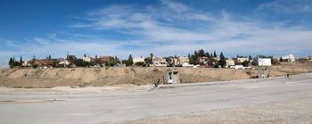
Arad is located mostly on the western and southwestern Kidod Range, and the Arad Plain,[15] which marks the southwestern end of the Judean Desert in southern Israel. It is located 23 kilometers (14.3 mi) west of the southern end of the Dead Sea, and is by road, 45 kilometers (28.0 mi) east of Beer Sheva, 111 kilometers (69.0 mi) south of Jerusalem, 138 kilometers (85.7 mi) south east of Tel Aviv, and 219 kilometers (136.1 mi) north of the southern-most city of Eilat.[16]
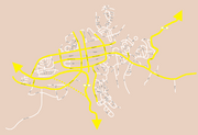
The city spans an area of 93,140 dunams (93.1 km2; 36.0 sq mi),[2] one of the largest municipal areas in Israel, even though its urban area is much smaller. In 1993, the city's jurisdiction was 73,934.3 dunams (73.9 km2; 28.5 sq mi), still many times larger than the urban area.[17] The historical site of Tel Arad and the Arad Park (also known as Ran Grove) can also be found within its municipal area, west of the urban core. Arad also has a commercial landing strip located slightly to the south of its urban core. It borders the Tamar and Abu Basma regional councils, and the closest local municipality to Arad is the Bedouin local council Kuseife.
Neighborhoods
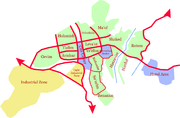
Each neighborhood in Arad contains streets named in a thematic manner, for example, a neighborhood where all streets are named after jewels. The exception to this are the four central quarters which have more conventional street names, and the original two neighborhoods (Rishonim and Ne'urim). The themed neighborhoods make up the entire city north of Highway 31. South of the highway is Arad's industrial zone (the northern area being the light industry zone). The neighborhoods are as follows:
| Name | Meaning | Theme |
|---|---|---|
| Avishur | Abishur | |
| Tlalim | Dew (plural) | |
| Leva'ot | Lionesses | |
| Ye'elim | Ibexes | |
| Gevim | Cisterns | Fluvial bodies |
| Halamish | Flint | Fruits |
| Yehoshafat (under construction) | Jehoshaphat | Kings of Israel and Judea |
| Rishonim | Pioneers | |
| Ne'urim | Youth | |
| Renanim (under construction) | Joys | Music |
| Ayanot | Springs | Springs |
| Ma'of | Flight | Birds |
| Hatzavim | Squills | Military |
| Harduf | Oleander | Heights (figurative) |
| Shaked | Almond | Plants |
| Rotem | Broom | Jewels |
Geology and topography
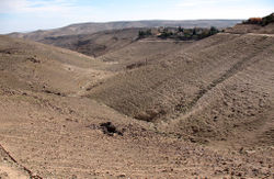
The western part of Arad is made up of Loess land, while the eastern part is made up of sedimentary rock, including chalk, flint and dolomite.[18]
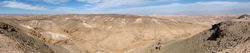
Arad's elevation ranges between approximately 361.5 and 631.1 metres (1,186 and 2,071 ft) above sea level,[2] a notable peak being Mount Kidod (600 m/1,969 ft), located at the northeastern point of the city and named after Ras al-Kadadeh, the Arabic name for the hill.[5][6] Other peaks within the municipal borders include Mount Kina (635 m/2,083 ft) and Mount Brir (537 m/1,762 ft). There are several wadis that pass through Arad, notably the Ye'elim Stream (which runs along Highway 31) and Tze'elim Stream. Others include the Hesed, Keisan, Kidod, Kina, Malhata, Pra'im, Tavya, and other streams.[19]
Climate
Between 1964 and 1974, Arad's average temperature in January was 11 °C (52 °F), and 27 °C (81 °F) in July. The average yearly precipitation between 1960 and 1990 was 150 millimetres (5.9 in),[2] and 158 millimetres (6.2 in) between 1962 and 1978.[18] Arad is thus situated in an arid area, where most precipitation falls in the winter months of December, January and February. It does however, on rare occasions snows. Two examples are the massive snowstorm during the 1991–92 winter that swept through entire mountainous of the Negev and January's snowstorm of 2008.[20][21]
Demographics
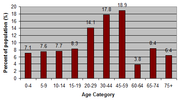
According to the Israel Central Bureau of Statistics, of Arad's 23,300 2005 population, 82% were Jews, and another 17.2% were other non-Arabs. 11,100 (~47.6%) were men and 12,200 were women. 42.9% (the second highest in the country) were immigrants since 1990.[2] Arad's population peaked in 2002 at 24,500.[22] Since then, it has been undergoing a steady decline, with a 23,300 low in 2006. However, CBS estimates that the population has risen to 23,400 in 2007.[1] Arad's former mayor, Moty Brill, said that the reason for the city's decline is its failure to absorb the massive immigration from Russia.[23] In early 2007, a study ordered by the Israeli Housing and Construction Ministry found that Arad suffered from a negative image, and described it a "settlement that drives residents away".[24] In March, The Ministerial Committee on Development in the Negev and Galilee approved a plan to move the State Archives from Jerusalem to Arad and to subsidize the costs of land development for reserve soldiers, anticipating the IDF's plan to relocate its training bases to the Negev.[25]
In 2005, Arad had 10,227 (~43.9%) salaried workers and 476 (~2%) self-employed. 10,474 were receiving children's benefits, 290 were receiving unemployment benefits, and 2,010 were receiving income guarantee. The average monthly income for self-employed workers was NIS 5,694,[26] up 10.2% from 2004's 5,165,[2] with salaried employees earning an average of NIS 5,686 (NIS 7,531 for men and NIS 3,904 for women).[26]
The IDF's City of Training Bases, which is located near Beersheba and under construction, hopes to bring thousands of soldiers (mostly officers, senior NCOs and other staff) to live in the Negev, including Arad. Orli Yehezkel, the CEO of the Ministry for the Development of the Negev and Galilee, told in her visit to Arad that NIS 4.5 million will be invested in Arad, including a subsidy of NIS 1,000 per family per month for two years for families of soldiers wishing to move to Arad.[27]
Economy
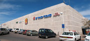
Other than tourist venues, Arad's commerce is mostly concentrated in the central commerce area, as envisioned in the original plan. There is one shopping mall in the city, the Arad Mall, in the northern block of the commerce sector.[28] In addition to the main area, there are small shop clustern in most neighborhoods in the city, notably a building called The Star (HaKokhav) in the Tlalim quarter. A lone supermarket outside the center, Mega in the City, is located in the industrial zone, near the entrance to the city, and a major shopping complex is planned near it by a real estate company called Zim Centers. Another important commercial center in Arad is the Arad Market, open only on Mondays, located in the light industry zone.[29]
Among the companies with manufacturing plants in Arad are Arad Textile Industries, one of Israel's largest producers of towels, Motorola Israel, A.M.S. Electronics who manufacture printed circuit boards and electronic products, El-Ran Timber Industries, Jordael who manufacture cosmetic products, and a Unilever Shefa Israel cereal plant. Since 1971, Arad has been producing phosphoric acid, made from brine collected from the Dead Sea, and phosphates from the nearby Tzefa.[9] Rotem Amfert Negev Ltd, a subsidiary of Israel Chemicals Ltd (ICL), has been planning a new phosphate plant in the Sdeh Brir area for several years. In 2008, the Ministry of the Environment decided not to contest the company's bid, despite studies showing it may increase air pollution-related deaths in the area.[30]
Tourism
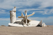
Other than the annual music festival, Arad has two main tourist venues—its clean air, which brings asthmatics from all over the world to the city, and its proximity to the Dead Sea, which allows tourists to pay much less for accommodation as well as having municipal services nearby, and still be able to easily reach the sea.[9] To that end, there are three hotels in the city—Inbar, Yefe Nof Arad and Margoa Arad.[31] However, Arad's municipality is trying to encourage other tourist venues, such as hiking and ecological tourism. Additionally, travellers to Masada may also prefer to stay in Arad, which is the closest (22 km/13.7 mi by road) urban settlement to this popular site, and the only way to reach its western side.[32] On the outskirts of Arad, near the hotel area, there is a large white monument conceived by Yigal Tumarkin in 1968, called Mitzpe Mo'av (Mo'av Lookout), which also offers a view of the Judean Desert.[33]
The Israel National Trail passes through Arad, between Mount Kina and Tel Arad, a major archeological dig and tourist attraction. Although not located within Arad's jurisdiction, the Zohar Peak (552 m/1,811 ft) and Zohar Lookout (Mitzpe Zohar) are common hiking and biking destinations on the national trail. The trails codenamed 11335 and 11240 run along the national trail in this area.[34]
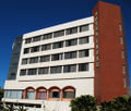 Inbar Hotel |
 Margoa Arad Hotel |
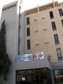 Yefe Nof Arad Hotel |
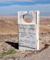 Explanatory plaque at Mitzpe Mo'av |
Culture and recreation
Culture and entertainment
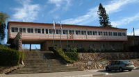
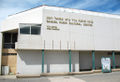
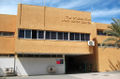
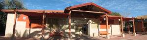
Arad's main cultural center is the Center for Culture, Youth and Sports (Hebrew: מתנ"ס, Matnas), named after Samuel Rubin and located on Ben Yair Street near the city's only mall, the Arad Mall.[28][35] It was built in 1983[36] and contains the Arad Museum, Arad's public library, a concert hall, a tourist information center about the Judean and Negev deserts (called Arad Visitor Center, founded in 1989), which is temporarily closed, and various related offices.[10]
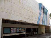
The Oron Theater (formerly also a cinema), planned by the architect Menachem Cohen, is another important culture and entertainment venue in the city although the city's main cinema, formerly located in the mall, was closed down during the tenure of mayor Moty Brill, due to lack of demand. The city also has an artists quarter, Eshet Lot, which is a section of Arad's industrial center on the road leading to the Dead Sea, mostly being in old hangars no longer used for industry.[37] The city also has a conservatory and concert hall.[38] In accordance with the 7 March 2007 decision taken by the Ministry for the Development of the Negev and Galilee to move the national archive of Israel from Jerusalem to Arad, a museum is planned, which will display various gifts given to Israeli politicians over the years.[39][40]
Arad has been widely known for its Hebrew Music Festival, held annually around summertime since 1982. The festival was a great opportunity for new artists to become known, but also attracted Israel's best musicians and bands as it grew. On 18 July 1995, three teenagers were crushed to death by a falling gate, which was torn down by the pressure of a large crowd whilst trying to watch the farewell concert held by the then popular band Mashina. Since then the festival has become a minor event. Due to this catastrophe, five of the festival's organizers received prison sentences of up to one year.[41]
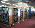 Public library |
 Culture, youth and sports center |
 Arad Visitor Center |
Parks, recreation and sports
The main public park and picnic area in Arad is the Arad Park, also called the Ran Grove (after Ran Schochat, who was killed in the Yom Kippur War[42]), which is located about 8 kilometers (5.0 mi) west of the city center and measures 3,000 dunams (3.0 km2; 1.2 sq mi).[6] Other notable parks include:
- Gan HaPsalim (a.k.a. Park HaNsharim), the park at the entrance to the city, with monuments of various desert animals[43]
- Gan HaHamisha (Garden of the Five), a memorial park for the five residents of Arad who were killed in action in the Six-Day War.[42] Includes a monument for the soldiers, as well as a stone structure called Amud HaBulbusim (lit. Pillar of the Potatoes, because of its shape), which marks Arad's place in the desert and their residents' control of the territory according to Bedouin tradition – designed by Yona Pitelson.
- Northern Park, to the north of the Halamish neighborhood[44]
- Gan Harpatka'ot (Adventure Park), a large playground and open grass area in the Rishonim neighborhood[45]
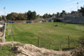
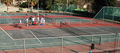
The main cluster of recreational facilities in the city is located in a small neighborhood known as Ayanot, also called the Sports Town (Kiryat HaSport). The area contains a swimming pool, tennis courts, a country club and various playgrounds.[46] The city's main football stadium is located outside of this cluster, on the corner of Yehuda and Palmach Streets. The stadium is home to Hapoel Arad, who currently play in Liga Alef, the third tier of Israeli football, with occasional relegations to Liga Bet.[47][48]
Arad has also hosted a mountain biking tournament annually since 2000, called Riding Arad, in honor of Itamar Ilya, a soldier killed in action in Lebanon in 1997. In March 2008, the tournament became part of an international Union Cycliste Internationale competition, which is co-hosted by Misgav and Ma'alot. Arad's professional course is 37 kilometers (23.0 mi) long, whilst the expert course is 22.5 kilometers (14.0 mi).[49][50]
 Arad's football stadium |
 Tennis courts in Arad's recreation area |
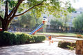 Gan Avishur, a playground near the Avishur school. The duck, a minor landmark, has been dismantled. |
 3rd Junior Chess Tournamest, hosted by the Arad Mall |
Services
Healthcare
Arad does not have a hospital, but there are numerous medical clinics, including Clalit, Leumit and Maccabi. Emergencies are handled by the single Magen David Adom station, located in the municipal compound.
A medical center was also built in the compound in 2004, named Schaller Medical Centre after Leon and Freda Schaller from London, who were the prime donors. It serves as an emergency ward, but does not have the equipment needed to perform operations, and such patients are transferred to the Soroka Medical Center. On average, 10% of the patients are transferred.[51]
Law enforcement
Arad is served by a local Israel Police station, located next to the municipal compound and the Magen David Adom station. It is commanded by Superintendent Yuval Paz[52] and has 58 members.[53] Arad's station also serves the Sodom area.[54]
Arad's police force was chosen as the exceptional force for 2007, and awarded an award of excellence on 5 March 2008. Among others, a severe reduction in property crime was cited. Arad's force was able to reduce the amount of such crimes from 1,092 in 2003 to just 168 in 2007.[53][54] On 18 July 2008, Arad police, in a rare incident, shot dead a man threatening to kill his ex-wife with a knife.[55]
Education and religion
Arad has a public elementary school in every central neighborhood (Halamish, Tlalim, Avishur, Leva'ot and Ye'elim (called Ye'elim-Ofarim)), whilst Tlalim is a religious school.[56] There is one public middle school, Re'ut, located near the junction of the Yoshiyahu and HaKana'im streets. The second middle school, Allon, was closed in 2007 and merged into ORT Arad, the city's only public secondary school, which shares a building with the Re'ut middle school and the former Yigal Allon school.[57] In the 2006–07 school year, 57.14% of Arad's 12th graders were eligible for a Bagrut (matriculation) certificate, compared to a national average of 45.9%. In the 2007–08 year, the number dropped to 49.67%, compared to a national average of 46.3%.[58]
In addition, there are several private and Haredi schools in Arad, such as the Shuvu movement's grades 1-8 school, and the Gerrer Haredi school.[56] Other Haredi schools include the boys' Beit Ya'akov and girls' Kol Ya'akov in the Halamish neighborhood, the Lev Simcha Yeshiva, and the Beit Ya'akov High School. Religious Zionist schools include the Ne'ot Avraham Bnei Akiva Ulpana, which also provides young women with the guidance to perform volunteer activities in the community,[59] and the Tlalim Elementary School, founded in 1971.[60]
Also in Arad is the Kedem Democratic School, which is an alternative school for students up through the high school level. It allows students to create their own schedules, and choose how they would like to spend their entire day at school.
SOS Children's Village Arad (known as Kfar Neradim) was built in the southern outskirts of Arad and inaugurated on 27 October 1981. It consists of twelve family houses, to accommodate up to 120 children. There is also an SOS Youth Facility to accommodate 12 to 14 youths from the SOS Children's Village. In January 2005, an SOS Social Centre was opened at Arad. It runs a day-care center and various community outreach programmes to support socially weak families.[61] Until fall 2008, the World Union of Jewish Students (WUJS), funded by Jews from New Jersey, had an institute in Arad which allowed post-college young Jews from around the world to study Israeli society and the Hebrew language. When WUJS's ownership changed, the institute was moved to the center of the country.[62]
Arad has 22 synagogues, of which 11 are Ashkenazi, 9 are Sephardi, one is Yemenite, and one is Ethiopian. Both the central Ashkenazi and Sephardi synagogues are located in the Ye'elim neighborhood. There are Gerrer synagogues in Avishur and Halamish, and a Chabad synagogue in Ye'elim.[63] There are two mikvas in the city—in the Tlalim and Ayanot neighborhoods.[64] The city also has a small Messianic community that is being accused of illegal missionary activities by the Haredim and certain right-wing groups.[65] Arad's dead are mostly buried in the local cemetery, located in the northeastern outskirts of the city, close to the road to Masada.
Media
Arad had its own local newspaper since its beginning, named Kidod. It was published by the entrepreneurs Eli and Rochale Ziv, who were also two of the founders of Arad. Kidod started as a small leaflet in December 1966 and grew up to a full paper few years later. In its peak, it was circulated, free of charge, in groceries, kiosks, etc., in 3,000 copies each week. Kidod ran for 23 years and had a key role in the cultural and community life of Arad. HaTzvi Arad is the city's current newspaper, and other small publications exist as well.
 ORT Arad HS, formerly Yigal Allon Junior High |
Secondary building of the Avishur elementary school |
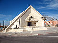
 Central Ashkenazi synagogue |
 Rotem neighborhood synagogue |
Government
Arad has, since its inception in 1962, been under the governance of a regional council and local council, before being designated as a city council in 1995. Democratic elections have been held in Arad since 1966, although only Avraham Shochat, Betzalel Tabib and Moty Brill were ever elected or re-elected as the head of the municipality. The first mayor of the city of Arad was Betzalel Tabib who served as both head of the local council and city council. He was replaced by Mordechai Brill in 2003, although due to his inability to pass a yearly budget, Brill was dismissed by the Minister of the Interior Meir Sheetrit in August 2007, and a government-appointed clerk, Gideon Bar-Lev, took his place.[66] An election took place again on April 13, 2010, won by Tali Ploskov of the Yisrael Beiteinu party.[67] The longest serving head of Arad's municipality was Avraham Shochat who served as head of the local council between 1967 and 1986.[7]
Arad's yearly budget is over 100 million NIS and over $30 million USD. On 27 December 2007, the 2008 budget was unanimously passed at NIS 123 million by the city council. The city's total income for the year is estimated at approximately NIS 119 million.[68]
| Name | Term | Position | Party |
|---|---|---|---|
| Aryeh "Lyova" Eliav | 1960 – June 1962 | Head of Arad Regional Council | Mapai |
| Yitzhak Pundak | June 1962 – 1965 | Head of Arad Regional Council | |
| Yitzhak Pundak | 1965–1966 | Head of local council | |
| Ze'ev Haimoni | 1966–1967 | Head of local council | Mapam |
| Avraham Shochat | 1967–1986 | Head of local council | Labor |
| Betzalel Tabib | 1986 – 29 June 1995 | Head of local council | Labor |
| Betzalel Tabib | 29 June 1995 – October 2003 | Mayor | Labor |
| Mordechai "Moty" Brill | October 2003 – August 2007 | Mayor | |
| Gideon Bar-Lev | October 2007 – April 2010 | Mayor | |
| Tali Ploskov | April 2010–date | Mayor | Yisrael Beiteinu |
While it is not customary for Israeli cities to have major unique/auxiliary laws, many cities have minor laws. In Arad, it is illegal to feed animals in public places.[69] It is also illegal to sell or consume sunflower seeds, peanuts, etc. in public places, due to an anti-littering law enacted in 1965.[70] There are in all 27 auxiliary laws in Arad, which were enacted between 1965 and 2000.[71][72]
Transportation
There are two ways to get to Arad: by air or road. The only highway connecting Arad with the rest of the country is Highway 31, which connects it with Beersheba to the west, and the Dead Sea to the east. It has two junctions within Arad's municipal area—the Arad Junction (within the city itself, with Road 3199), and the Tel Arad Junction (with Highway 80).[73] The local Road 3199 connects Arad with Masada, but does not connect to the road next to the dead sea (Highway 90). It is therefore the only way to get to Masada's western side.[32]
Arad's airfield, which was first used during the music festival of 1994, is located to the south of the city, and serves domestic flights according to demand.[74] A railway line, which would also go through the Nevatim Airbase, is in the planning stages.[75][76]
The main bus station of Arad, Arad Central Bus Station, was located on the corner of Jerusalem (Yerushalayim) Street and Jeuda (Yehuda) Street. It has however been closed due to a legal battle between Arad's municipality and the Egged Bus Cooperative, and its bus stops are now located nearby on Jerusalem St. Construction of the central station officially restarted on January 18, 2009. The new station will include seven platforms and a large parking lot for park and ride. The planned cost of the project is NIS 4.5 million.[77]
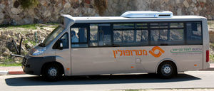
Buses in Arad are served by the Egged Bus Cooperative and, since 1 June 2007, also the Metropoline company.[78] A multitude of inter-city bus routes are served by the main station, two more inter-city Haredi routes which leave from the north, as well as two inner routes (1 and 2), with two alternatives (1a and 2a). The inter-city routes are as follows:[79][80]
| Line | Route | Company |
|---|---|---|
| 384 | Beersheba CBS – Ein Gedi | Egged |
| 385 | Beersheba CBS – Ein Bokek | Egged |
| 386 | Arad (center) – Beersheba CBS | Metropoline |
| 388 | Arad (center) – Beersheba CBS | Metropoline |
| 388a | Arad (center) – Lehavim Railway Station[81] | Metropoline |
| 389 | Arad (center) – Tel Aviv CBS | Egged |
| 441 | Arad (center) – Jerusalem CBS (Sundays only) | Egged |
| 550 | Arad (north) – Bnei Brak | Egged |
| 554 | Arad (north) – Jerusalem Har Hotzvim | Egged |
International relations
Twin towns — sister cities
 Wilmington, Delaware became a sister city of Arad in 1973, to commemorate the 25th anniversary of the State of Israel.[82]
 Dinslaken, Germany signed a twinning agreement with Arad in 1989.[83][84]
- Burlington, Vermont, developed a sister city relationship with Arad in 1991. Then Mayor Bezalel Tabib, along with Professor Walid Dajani, who represented Bethlehem, visited Burlington, Vermont to sign a three cities cooperative agreement—the first-ever sister-city pacts among American, Palestinian, and Israeli communities.[85]
References
Notes
- ↑ 1.0 1.1 "Table 3 - Population of Localities Numbering Above 1,000 Residents and Other Rural Population". Israel Central Bureau of Statistics. 2008-06-30. http://www.cbs.gov.il/population/new_2009/table3.pdf. Retrieved 2008-09-13.
- ↑ 2.0 2.1 2.2 2.3 2.4 2.5 "Local Authorities in Israel 2005, Publication #1295 - Municipality Profiles - Arad" (PDF). Israel Central Bureau of Statistics. http://www.cbs.gov.il/publications/local_authorities2005/pdf/234_2560.pdf. Retrieved 2007-11-25. (Hebrew)
- ↑ Kantor SZ, Frank M, Hoch-Kantor D, et al. (1966). "Airborne allergens and clinical response of asthmatics in Arad, a new town in a desert area in Israel". The Journal of allergy 37 (2): 65–74. doi:10.1016/0021-8707(66)90122-5. PMID 5217164.
- ↑ Frank M, de Vries A (1967). "Further observation on the clinical response of asthmatic settlers in Arad, Israel". The Journal of allergy 40 (3): 182–183. doi:10.1016/0021-8707(67)90007-X. PMID 5231431.
- ↑ 5.0 5.1 5.2 Vilnai, Ze'ev (1979). "Arad". Ariel Encyclopedia. Volume 7. Israel: Am Oved. pp. 6002–6003. (Hebrew)
- ↑ 6.0 6.1 6.2 6.3 Mapa's concise gazetteer of Israel. El'azari, Yuval (ed.). Tel Aviv, Israel: Mapa Publishing. 2005. pp. 434–435. ISBN 9657184347. (Hebrew)
- ↑ 7.0 7.1 7.2 "Arad - First Days - Preface". Arad Historical Museum. http://www.arad-museum.com/historyofarad.html. Retrieved 2007-11-30. (Hebrew)
- ↑ Efrat, Elisha (2009). Tzameret, Tzvi. ed. The Development Towns. Idan Series #24. Yad Ben Zvi. pp. 53–55. ISBN 978-965-217-298-3. (Hebrew)
- ↑ 9.0 9.1 9.2 Ben Yosef, Safi (general); Menahem Marcus (volume), ed (2001). "Arad". The New Israel Guide. Volume 14. Jerusalem, Israel: Keter Publishing House. pp. 196–197. ISBN 965-07-0902-9.
- ↑ 10.0 10.1 HaReuveni, Immanuel (1999). Lexicon of the Land of Israel. Miskal - Yedioth Ahronoth Books and Chemed Books. pp. 781–782. ISBN 965-448-413-7. (Hebrew)
- ↑ Krausz, Ernest; Glanz, David and Antonovsky, Aaron (1980). Studies of Israeli Society. Transaction Publishers. p. 225. ISBN 087855369X.
- ↑ "Arad - to Live Quality". Arad Municipality. http://www.arad.muni.il/89.html. Retrieved 2008-10-14. (Hebrew)
- ↑ "Visitor's Card". Arad Municipality. http://www.arad.muni.il/2.html. Retrieved 2008-10-14. (Hebrew)
- ↑ 14.0 14.1 Gutterman, Dov. "Arad (Israel)". Flags of the World. http://fotw.net/flags/il-arad.html. Retrieved 2008-10-14.
- ↑ Shmueli, Avshalom; Gardos, Yehuda, ed (1978-79). The Land of the Negev (English title). Vol. 2. Tel Aviv, Israel: Ministry of Defense. p. 575. (Hebrew)
- ↑ "Driving Distances". Israel Travel Tips. http://www.israel-travel-tips.com/en/132/Israel%20Travel/Driving%20Distances. Retrieved 2008-10-14.
- ↑ Esther Levinson, ed (April 1994). Statistical Yearbook for the Negev, #1 1993. Beersheba, Israel: Mi UMa Tikshoret Mekomit. p. 40. (Hebrew)
- ↑ 18.0 18.1 Shmueli, Avshalom; Gardos, Yehuda, ed (1978-79). The Land of the Negev (English title). Vol. 2. Tel Aviv, Israel: Ministry of Defense. p. 573. (Hebrew)
- ↑ Amud Anan. Topographic Maps and Hiking Routes [map]. Retrieved 2008-03-15. (Hebrew)
- ↑ "Blizzard of 2008 Update". Israel National News. 2008-01-30. http://www.israelnationalnews.com/News/Flash.aspx/140680. Retrieved 2008-03-20.
- ↑ "Daily Herald - Rare Snowstorm paralyzes cities throughout Mideast". Daily Herald. 1992-01-03. http://www.newspaperarchive.com/LandingPage.aspx?type=nlp&search=1991%20snow%20negev&img=\\na0033\6769623\25690341.html. Retrieved 2008-03-20.
- ↑ "Population and Density per Km² in Localities Numbering Above 5,000 Residents". 55th Statistical Yearbook. Israel Central Bureau of Statistics. 2003. http://www1.cbs.gov.il/shnaton55/st02_14.pdf. Retrieved 2008-03-15.
- ↑ Ben Simon, Daniel. "Oh no, just like Dimona". Haaretz. http://www.haaretz.co.il/hasite/pages/ShArtPE.jhtml?itemNo=457211&contrassID=2&subContrassID=13&sbSubContrassID=0. Retrieved 2008-10-14. (Hebrew)
- ↑ Mirkovsky, Arik (2007-01-16). "The Ministry of Housing's recommendation to settling the Negev and Galilee: Start spreading the population, don't stop spending money". TheMarker. http://law.themarker.com/tmc/article.jhtml?ElementId=skira20070126_201457&layer=realEstate&layer2=&layer3=realEstate. Retrieved 2008-10-14. (Hebrew)
- ↑ Grinberg, Mijal (2007-03-07). "State to move archives to Arad as part of Negev development plan". Haaretz. http://www.haaretz.com/hasen/spages/834401.html. Retrieved 2008-10-14.
- ↑ 26.0 26.1 "Local Authorities in Israel 2006, Publication #1315 - Municipality Profiles - Arad" (PDF). Israel Central Bureau of Statistics. http://www.cbs.gov.il/publications/local_authorities2006/pdf/186_2560.pdf. Retrieved 2008-10-14. (Hebrew)
- ↑ Bar Sadeh, Eliezer (2008-02-14). "Arad Will Be a Focused City". 439th Edition (HaTzvi Arad). http://www.aradnik.co.il/30428/ערד-תהיה-עיר-ממוקדת---14-2-גליון-439. Retrieved 2008-02-16. (Hebrew)
- ↑ 28.0 28.1 Arad Municipality. Tourist Map of Arad [map]. Section He3. Retrieved 2008-03-15.
- ↑ Bar Sadeh, Eliezer (2008-07-23). "Real Estate Company Zim Plans to Construct Giant Shopping and Entertainment Center in Arad". 462nd Edition (HaTzvi Arad). http://www.aradnik.co.il/30428/חברת-הנדל-ן-צים-מתכוונת-להקים-בערד-מתחם-ענק-לקניות-ובילוי---23-7-גליון-462. Retrieved 2008-08-01. (Hebrew)
- ↑ Ben-David, Amir (2008-04-30). "Environmental Ministry supports building polluting factory near Arad". Ynetnews. http://www.ynetnews.com/articles/0,7340,L-3537307,00.html. Retrieved 2008-07-28.
- ↑ "Arad Hotels". Tripadvisor.com. http://www.tripadvisor.com/Hotels-g297737-Arad-Hotels.html. Retrieved 2008-03-16.
- ↑ 32.0 32.1 Mapa. Gold Atlas [map], 2007 edition, 1:100,000. ISBN 965-521-057-7. p. 42, section Vav23. (Hebrew)
- ↑ "Hiking Trails". Arad Municipality. http://www.arad.muni.il/139.html. Retrieved 2008-10-14. (Hebrew)
- ↑ 11240 Trail Map (image). Retrieved on 2008-10-14.
- ↑ "Matnas Index". http://www.matnachim.co.il/Show_IndexMatnasim_Item.asp?MatnasID=195. Retrieved 2008-03-15. (Hebrew)
- ↑ "About the Library - Some History". Arad Municipality. http://www.arad.muni.il/245.html. Retrieved 2008-02-16.
- ↑ Sa'ar, Dana (2005-07-25). "Go Out Into the Desert". http://www.megalim.co.il/inner.asp?category_code=6&object_id=8008. Retrieved 2008-04-10. (Hebrew)
- ↑ "Arad City Conservatory". http://cms.education.gov.il/EducationCMS/Units/AgafA/Music/ConservatorionimVebateySefer/hide/ConservatoriumArad.htm. Retrieved 2008-04-10. (Hebrew)
- ↑ Grinberg, Mijal (2007-03-07). "State to move archives to Arad as part of Negev development plan". Haaretz. http://www.haaretz.com/hasen/spages/834401.html. Retrieved 2007-11-30.
- ↑ "National Archive Moves to Arad". 2007-03-11. http://www.arad.muni.il/116.html?&cHash=ece90070be&tx_ttnews%5BbackPid%5D=138&tx_ttnews%5Btt_news%5D=17. Retrieved 2007-11-30. (Hebrew)
- ↑ Kaplan, Reuven (2001-12-26). "Got Away Easily". NRG Maariv. http://www.nrg.co.il/online/archive/ART/227/757.html. Retrieved 2007-11-27. (Hebrew)
- ↑ 42.0 42.1 "Remembering the Fallen Sons of Arad". HaTzvi Arad. http://aradnik.co.il/30428/הנצחת_הבנים_הנופלים_בערד_194. Retrieved 2008-10-14. (Hebrew)
- ↑ Arad Municipality. Tourist Map of Arad [map]. Section Het4. Retrieved 2008-03-15.
- ↑ Arad Municipality. Tourist Map of Arad [map]. Section Vav4. Retrieved 2008-03-15.
- ↑ Arad Municipality. Tourist Map of Arad [map]. Section He4. Retrieved 2008-03-15.
- ↑ Mapa. Gold Atlas [map], 2007 edition, 1:13,500. ISBN 965-521-057-7. p. 362, section Dalet3.
- ↑ "Liga Bet, South B". ONE.com. July 2008. http://www.one.co.il/c.aspx?target=%2Fsitectr2%2Easp%3FCategoryID%3D1%26TableID%3D731%26TeamID%3D0%26PlayerID%3D0%26Season%5FID%3D07%2D08%26nocache%3D1. Retrieved 2008-10-14. (Hebrew)
- ↑ "Liga Alef!". 454th Edition (HaTzvi Arad). 2008-05-28. http://www.aradnik.co.il/30428/ספורט-28-5-גליון-454. Retrieved 2008-06-03. (Hebrew)
- ↑ "International Biking Race in Arad". 443rd Edition (HaTzvi Arad). 2008-03-13. http://www.aradnik.co.il/30428/מרוץ-אופני-הרים-בינלאומי-בערד----13-3-גליון-443. Retrieved 2008-03-13. (Hebrew)
- ↑ "Riding Arad 2008 - Details". http://www.shvoong.co.il/secondLevel/detailes.asp?event_id=2484. Retrieved 2008-10-14. (Hebrew)
- ↑ Riskin, Anat (2008-02-28). "Advanced X-Ray Acquired for Frontal Emergency Ward". 441st Edition (HaTzvi Arad). http://www.aradnik.co.il/site/detail/detail/detailDetail.asp?detail_id=783748&seaWordPage=%22%D7%A9%D7%90%D7%9C%D7%A8%22. Retrieved 2008-03-18. (Hebrew)
- ↑ Riskin, Anat (2008-09-26). "The Police Chief has a Vision". 471st Edition (HaTzvi Arad). http://www.aradnik.co.il/30428/למפקד-המשטרה-יש-חזון-26-9-08-גליון471. Retrieved 2008-10-04. (Hebrew)
- ↑ 53.0 53.1 Riskin, Anat (2008-03-13). "Award for Excellence to Arad Police". 443rd Edition (HaTzvi Arad). http://www.aradnik.co.il/30428/תעודת-הצטיינות-למשטרת-ערד---13-3-גליון-443. Retrieved 2008-03-13. (Hebrew)
- ↑ 54.0 54.1 "Property Crime in Arad Station's Jurisdiction, Including Sodom, over the Years". Arad Municipality. http://www.arad.muni.il/249.html. Retrieved 2008-10-14. (Hebrew)
- ↑ Atlas, Yonat (2008-07-18). "Knife-Wielding Man Killed by Police After Threatening Ex-Wife". Ynetnews. http://www.ynetnews.com/articles/0,7340,L-3570084,00.html. Retrieved 2008-07-18.
- ↑ 56.0 56.1 "Elementary schools in Arad". HaTzvi Arad. http://www.aradnik.co.il/30428/בתי_הספר_היסודיים_בערד. Retrieved 2008-02-16. (Hebrew)
- ↑ Bar Sadeh, Eliezer (2007-12-27). "2007 Summary". 432nd Edition (HaTzvi Arad): p. 12. http://www.livecity.co.il/image/users/30428/ftp/my_files/kvazhim/Hazre012.pdf. Retrieved 2007-12-27. (Hebrew)
- ↑ Riskin, Anat (2008-08-13). "Percentage of Matriculation Receivers in Arad at 49.67% This Year - Just Above the National Average and Lower than Last Year". 465th Edition (HaTzvi Arad). http://www.aradnik.co.il/30428/אחוז-הזכאים-לבגרות-השנה-בערד---13-8-גליון-465. Retrieved 2008-08-16. (Hebrew)
- ↑ "Neot Avraham Bnei Akiva Ulpana in Arad". Jewish Agency for Israel. 2006-06-18. http://www.jewishagency.org/JewishAgency/English/Israel/Partnerships/Regions/Arad/News/2006/news-0606-ulpana.htm. Retrieved 2008-04-10.
- ↑ "Tlalim School - About Us". http://www.orianit.edu-negev.gov.il/tlalimard/cp/homepage/ancno.htm. Retrieved 2008-10-14. (Hebrew)
- ↑ "SOS Children's Village Arad (Neradim)". SOS Children's Villages - Canada. http://www.soschildrensvillages.ca/Where-we-help/Asia/Israel/Arad-Neradim/Pages/default.aspx. Retrieved 2008-10-14.
- ↑ Hoffman, Gil (2008-07-10). "Student Program's Exit Deals New Blow to Arad". Jewish Agency for Israel. http://www.jewishagency.org/JewishAgency/English/Israel/Partnerships/Regions/Arad/News/2008/July10njjn.htm. Retrieved 2008-10-14.
- ↑ "Synagogues in Arad". HaTzvi Arad. http://www.aradnik.co.il/site/detail/detail/detailDetail.asp?detail_id=245097. Retrieved 2008-10-14. (Hebrew)
- ↑ "Arad - Mikvah". HaTzvi Arad. http://www.aradnik.co.il/site/detail/detail/detailDetail.asp?detail_id=245099. Retrieved 2008-10-14. (Hebrew)
- ↑ "Continuation of Do Unto Your Neighbor". Haaretz. 2004-04-28. http://www.haaretz.com/hasen/pages/ShArt.jhtml?itemNo=421251&contrassID=2&subContrassID=1&sbSubContrassID=0&listSrc=Y. Retrieved 2008-10-25.
- ↑ Grinberg, Mijal (2007-10-15). "Collapse of the Southern Municipalities - The Dismissed Mayor: The One Who Hampered (Arad's) Recovery Program was Appointed in My Stead". Haaretz. http://www.haaretz.co.il/hasite/spages/913003.html. Retrieved 2007-11-30. (Hebrew)
- ↑ "Tali Ploskov in a Landslide Victory". HaTzvi Arad. April 15, 2010. http://www.aradnik.co.il/30428/לי-פלוסקוב-בניצחון-סוחף---. Retrieved 2010-04-16. (Hebrew)
- ↑ Bar Sadeh, Eliezer (2008-01-03). "The Municipal Budget of Arad for 2008 was Passed". HaTzvi Arad. http://www.aradnik.co.il/30428/תקציב-עריית-ערד-לשנת-2008-אושר---3-1. Retrieved 2007-11-30. (Hebrew)
- ↑ Aisbitt, Shawn. "Weirdest Laws in the World!". Archived from the original on 2009-10-25. http://www.webcitation.org/5kmmoH9tp. Retrieved 2008-03-10.
- ↑ "Auxiliary Law for Arad (Cleanliness and Smoking Prohibition), 1965" (RTF). Israel Ministry of the Interior. http://www.moin.gov.il/Apps/PubWebSite/MIMunLaw.nsf/SysLawSearchView/F3D99B1A921A11EF422571A300390CCF/$FILE/MunicipalLaw.rtf. Retrieved 2008-10-14. (Hebrew)
- ↑ "Auxiliary Laws in Local Authorities - List of Auxiliary Laws for Local Authority - Arad". Israel Ministry of the Interior. http://www.moin.gov.il/Apps/PubWebSite/MIMunLaw.nsf/ShowLawsByPlaceMR?OpenAgent&unid=51BEFB644A13E7A4422569CD00467E0C&getFlag=YES. Retrieved 2008-03-10. (Hebrew)
- ↑ "Auxiliary Laws of Arad". Arad Municipality. http://www.arad.muni.il/294.html. Retrieved 2008-10-14. (Hebrew)
- ↑ Mapa. Gold Atlas [map], 2007 edition, 1:100,000. ISBN 965-521-057-7. p. 44, section Het24.
- ↑ Esther Levinson, ed (April 1994). Statistical Yearbook for the Negev, #1 1993. Beersheba, Israel: Mi UMa Tikshoret Mekomit. p. 73. (Hebrew)
- ↑ Riskin, Anat (2008-08-27). "They Are Coming". 467th Edition (HaTzvi Arad). http://aradnik.co.il/30428/%D7%91%D7%A1%D7%99%D7%A1-%D7%94%D7%AA%D7%95%D7%91%D7%9C%D7%94--%D7%91%D7%97-%D7%90-27--%D7%A2%D7%91%D7%A8-%D7%94%D7%A9%D7%91%D7%95%D7%A2-%D7%9C%D7%91%D7%A1%D7%99%D7%A1-%D7%A0%D7%91%D7%98%D7%99%D7%9D----27-8-%D7%92%D7%9C%D7%99%D7%95%D7%9F-467. Retrieved 2008-03-15. (Hebrew)
- ↑ Shmuelevich, Yeruham (2007-06-11). "The Railway is Coming to the Haredi Community". Ladaat.net. http://www.ladaat.net/article.php?do=viewarticle&articleid=1133. Retrieved 2008-10-18. (Hebrew)
- ↑ Riskin, Anat. "The Arad Central Bus Station". HaTzvi Arad. http://www.aradnik.co.il/30428/%D7%94%D7%AA%D7%97%D7%A0%D7%94-%D7%94%D7%9E%D7%A8%D7%9B%D7%96%D7%99%D7%AA-%D7%A2%D7%A8%D7%93----29-11. Retrieved 2007-11-30. (Hebrew)
- ↑ Bar Sadeh, Eliezer (2007-05-31). "Arad - Metropoline". HaTzvi Arad. http://www.aradnik.co.il/site/detail/detail/detailDetail.asp?detail_id=475872&seaWordPage=%22%D7%9E%D7%98%D7%A8%D7%95%D7%A4%D7%95%D7%9C%D7%99%D7%9F%22. Retrieved 2008-03-15. (Hebrew)
- ↑ "Official Website". Egged Bus Cooperative. http://www.egged.co.il. Retrieved 2008-10-14. (Hebrew)
- ↑ "Official Website". Metropoline. http://www.metropoline.com. Retrieved 2008-10-14. (Hebrew)
- ↑ Duak, Sharon (2007-06-28). "Arad - Israel Railways Stops at Lehavim". HaTzvi Arad. http://www.aradnik.co.il/site/detail/detail/detailDetail.asp?detail_id=499971&seaWordPage=%22%D7%9E%D7%98%D7%A8%D7%95%D7%A4%D7%95%D7%9C%D7%99%D7%9F%22. Retrieved 2008-03-15. (Hebrew)
- ↑ "Sister Cities of Wilmington, Inc. - Background". http://www.sistercitieswilmington.org/html/background.html. Retrieved 2008-06-12.
- ↑ "List of Twin Towns in the Ruhr Destrict". © 2009 Twins2010.com. http://www.twins2010.com/fileadmin/user_upload/pic/Dokumente/List_of_Twin_Towns_01.pdf?PHPSESSID=2edd34819db21e450d3bb625549ce4fd. Retrieved 2009-10-28.
- ↑ "Dinslaken-Arad (translated by Google)". Dinslaken-Arad.de. http://translate.google.com/translate?hl=en&sl=de&u=http://www.dinslaken-arad.de/&sa=X&oi=translate&resnum=2&ct=result&prev=/search%3Fq%3DDinslaken%2Barad%26hl%3Den. Retrieved 2008-03-15.
- ↑ "Sister Cities - The City Diplomacy of Burlington, Vermont". http://www.ci.burlington.vt.us/sistercities. Retrieved 2008-06-12.
&wrap=<a href="javascript:close();"> | </a>&md5=8da98c2903e95b77fe22de621b00ad2e)
External links
- Official website (Hebrew)
- Aradnik, the internet version of Arad's local HaTzvi weekly (Hebrew)
- Arad by Google Maps
- Arad GIS system (Hebrew)
|
||||||||||||||||||||